Shaking from the March 31, 2020 M6.5 Stanley earthquake, or one of the subsequent aftershocks, caused liquefaction of sediments near the inlet of Stanley Lake. Liquefaction is the processes in which shaking or vibration of saturated, unconsolidated soil causes a loss of strength. This can result in effects such as sand boils, lateral spreading, fissures, and ground subsidence.
Changes at the Stanley Lake Inlet Delta
On May 7th, colleagues from the US Forest Service pointed out that during a field visit to the inlet of Stanley Lake, the delta that used to form a popular beach and recreational site was now under many feet of water. Pictures from the field and reports of field observation suggest that the "disappearance" of the delta was caused by a combination of liquefaction/compaction of saturated sediments and possible sliding and lateral spreading of the delta into the deeper part of the lake.
This comparison of satellite images shows Stanley Lake before (left image, 11/13/2019) and after (right image, 5/4/2020) the main earthquake event and the initial aftershocks. The delta is clearly visible in the pre-earthquake image, but not in the post-earthquake image (for full resolution, please click here).
We don't yet have enough information to establish whether the failing of the delta was caused by the main shock or any of the stronger aftershocks with epicenters closer to Stanley Lake.

This picture of the NW corner of Stanley Lake, taken on April 9th, 2020, shows concentric fractures on the ice-covered surface of the lake atop the area of the inlet delta. The fracturing of the ice is likely associated with the collapse of the delta. The inlet creek is visible in the lower left corner of the picture. Photo courtesy: Ben VandenBos, Sawtooth Avalanche Center (https://www.sawtoothavalanche.com/).

Aerial view of the W shore of Stanley Lake and upstream area, showing modification of the shoreline and extent of areal flooding. Picture taken on May 12th, 2020. Photo courtesy: Ross Engle, Idaho Transportation Department Director of Flight Operations.
Field Reconnaissance
Following reports of shoreline changes by citizens and US Forest Service employees, Idaho Geological Survey staff visited Stanley Lake to document possible liquefaction effects. We recorded locations of liquefaction evidence, and collected ground and UAV photographs. The UAV photographs were processed into an orthophotograph, from which we mapped additional liquefaction features. The interactive map below displays the orthophotograph and the mapped features.
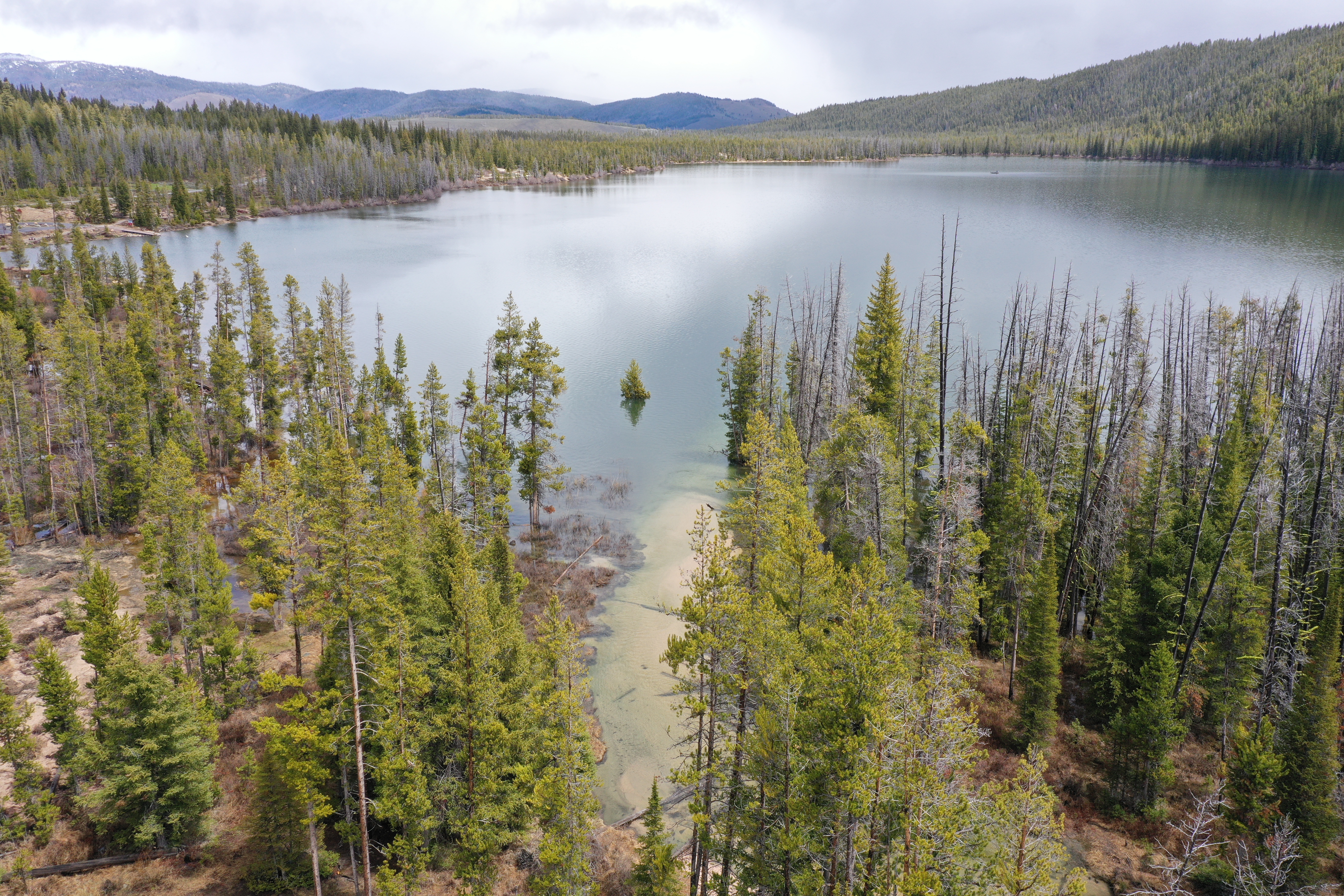
Oblique aerial view looking east across Stanley Lake. The inlet stream is in the foreground. The former delta was located where the inlet met the lake, but subsequently collapsed and subsided. Several mature trees that were growing on the delta are now partially submerged. Idaho Geological Survey, 5/15/2020.
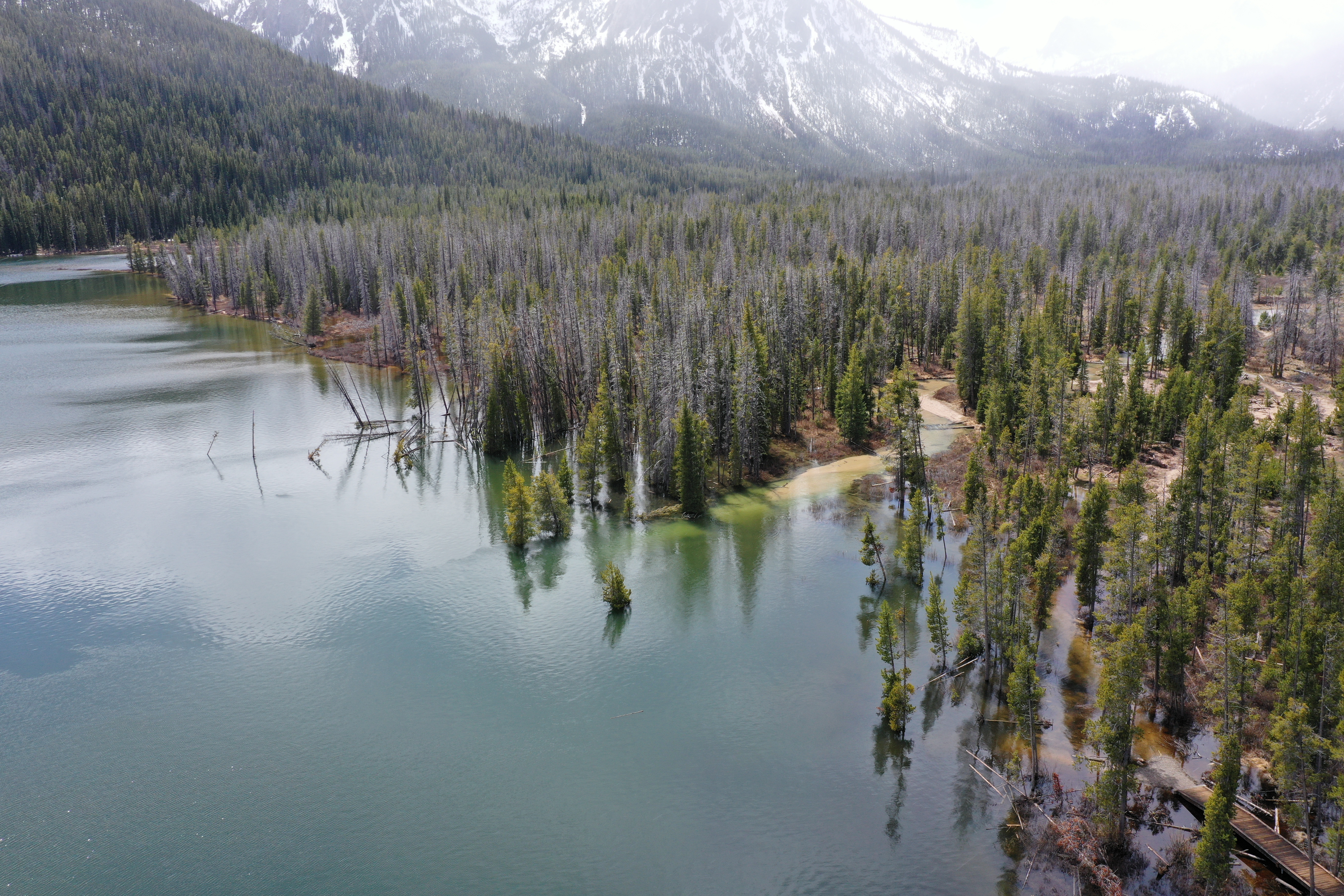
Oblique aerial view of the Stanley Lake inlet area looking south. Idaho Geological Survey, 5/15/2020.

Vertical aerial view of the inlet stream at Stanley Lake. Several tension cracks oriented parallel to the shoreline can be seen submerged in the water. These cracks formed when the delta sediments collapsed and laterally spread into the lake. Idaho Geological Survey, 5/15/2020.

Aerial view of the Stanley Lake shoreline adjacent to the inlet stream (sandy bed on left). Several tension cracks oriented parallel to the shoreline can be seen. Idaho Geological Survey, 5/15/2020.
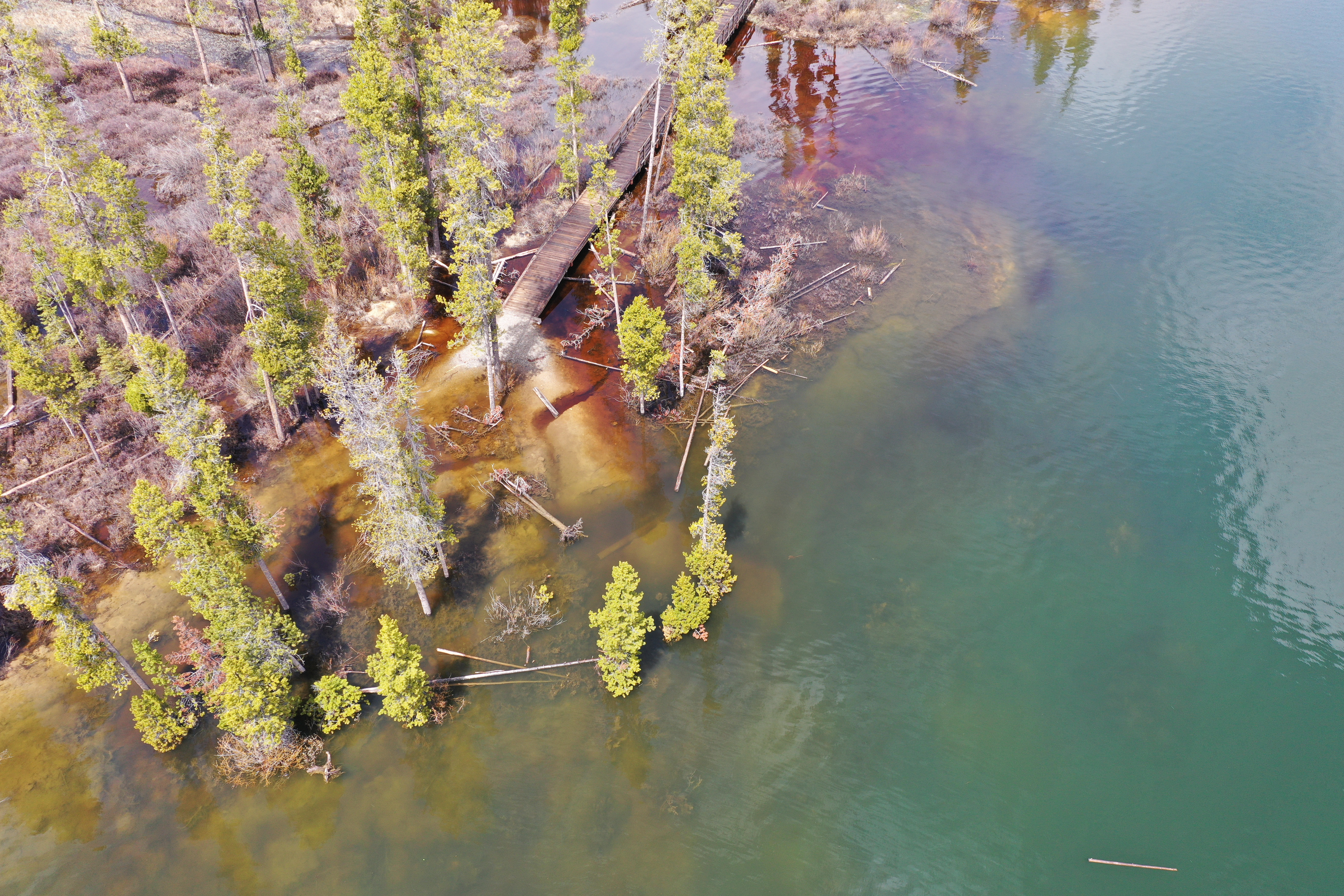
Aerial view of the Stanley Lake shoreline northeast of the inlet stream, showing subsidence and shoreline-parallel tension cracks near the boardwalk structure. Idaho Geological Survey, 5/15/2020.
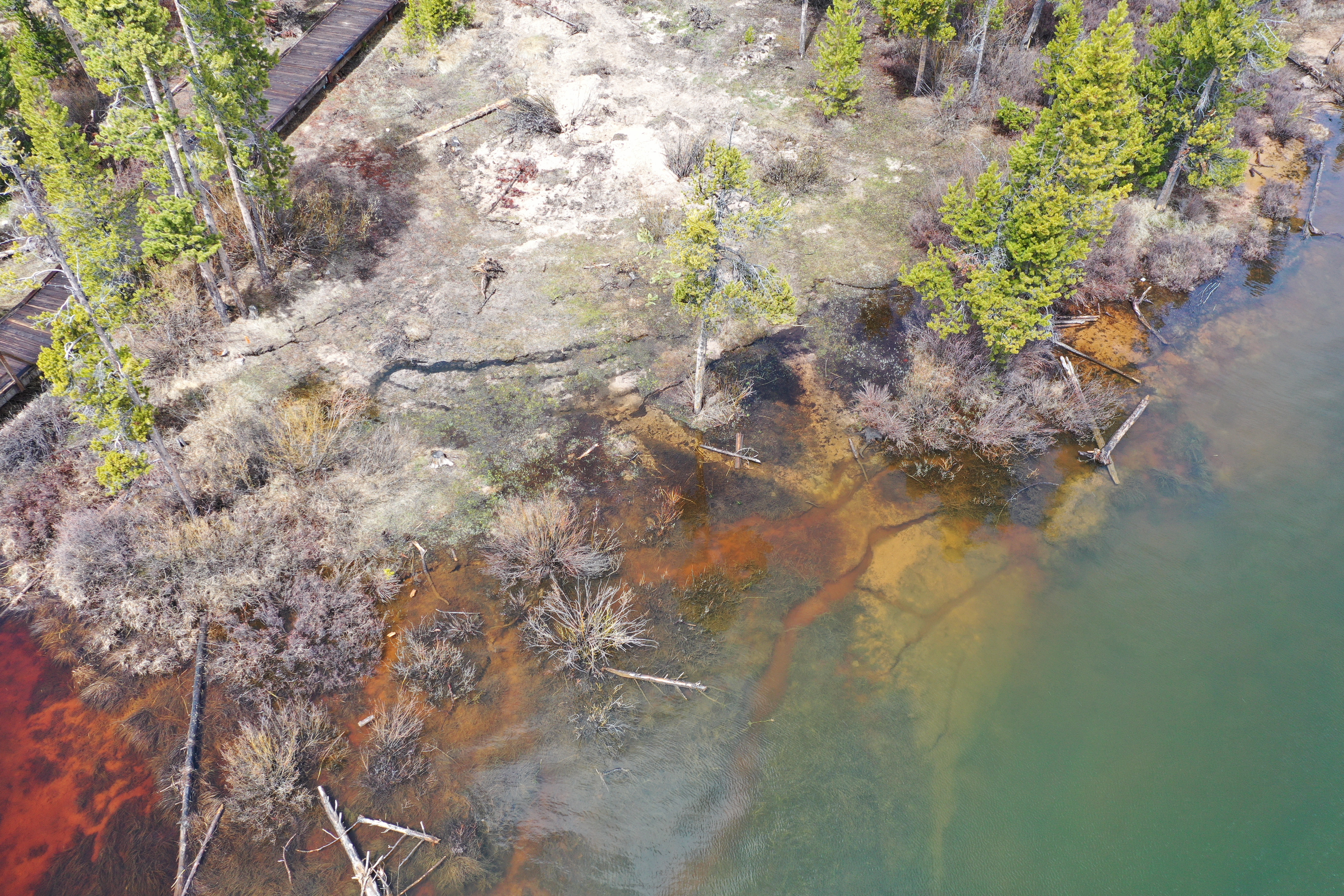
Aerial view of the Stanley Lake shoreline northeast of the inlet stream, showing subsidence and shoreline-parallel tension cracks near the boardwalk structure. Idaho Geological Survey, 5/15/2020.